
Pamukkale.ioHierapolis & beyondExplore
Tripolis: The Trade Town on the Maeander Route
Why the ancient city of Tripolis grew where the Maeander valley narrows, and how it linked Laodikeia and Hierapolis to Aegean ports along the trade route.
Updated
Why Tripolis was built on the Maeander
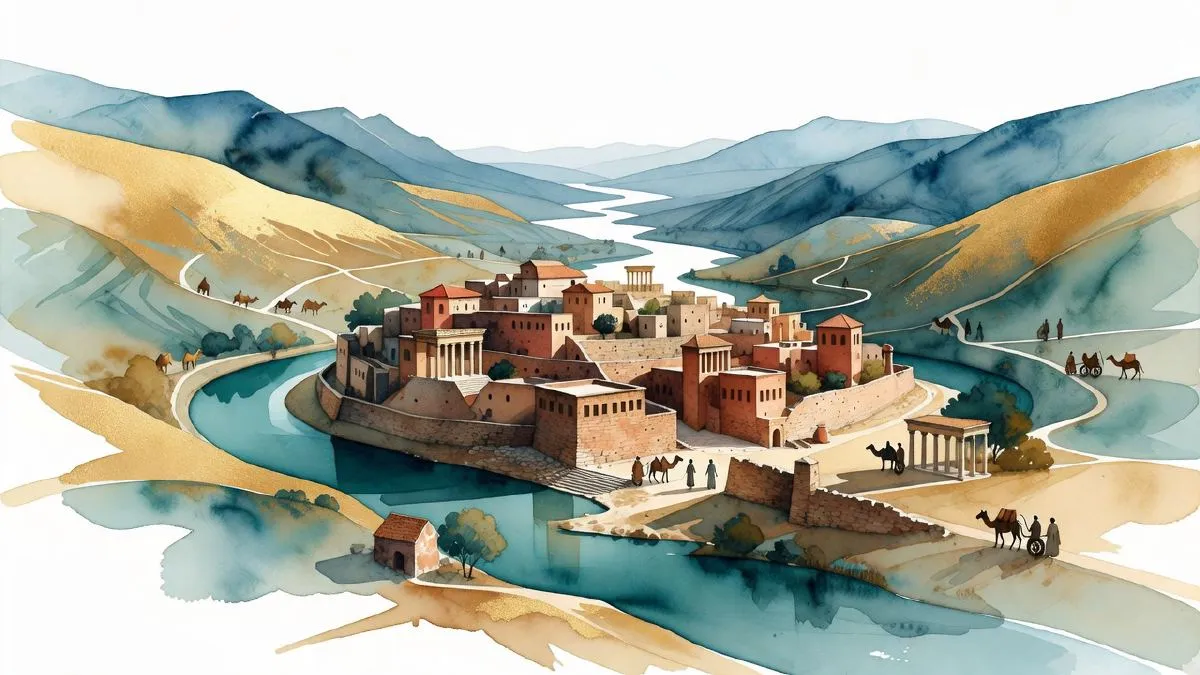
Tripolis stands on the Maeander where the river bends between the Buldan highlands and the Yenicekent plain, in the northwest of Denizli province. Its Roman title, Tripolis ad Maeandrum, ‘at the Maeander,’ pinned the town to the river, and the river was the road. Trade, grain, wool and travelers moved along this valley long before Rome paved a stone of it. Several cities in the Greek world carried the name Tripolis, so the river did the identifying; the full title is how Roman sources kept this one apart.
The Maeander valley worked as the main corridor between the Anatolian plateau and the Aegean coast. Phrygian grain, Lydian wool and ore from the mountain districts came down the valley to the ports of Ephesus and Miletus, and imports and travelers went back the same way. The valley offered the easiest line from the plateau to sea level, and the route carried the bulk of that traffic. A town on such a line mattered when it sat at a useful crossing, and Tripolis sat exactly at such a point: shelter for the night, a market for part of the cargo, a chance to refit animals and carts before the next stage.
The name ‘three cities’ reads as a border marker. Tripolis stood where the lands of Lydia, Caria and Phrygia came together, and the standard reading ties the name to that meeting of three regions. Ancient geographers counted the town as Lydian while noting that both Caria and Phrygia began at its doorstep. Anyone entering Tripolis crossed three provincial worlds in a single day’s walk.
That same position keeps the site quiet today. Tripolis stays empty while Pamukkale, a short drive up the valley, takes almost all of the region’s visitors. The exposed street grid and the walls facing the river still outline the crossing town the trade route paid for. What is walkable at the site now, and how to reach it, is covered in the separate visit guide to the ruins.
Valley economy: Tripolis, Laodikeia and Hierapolis in the same network
The Maeander valley was one of Anatolia’s busiest production corridors. Farms on the plateau grew grain and raised sheep; workshops in Laodikeia turned raw wool into finished cloth; Hierapolis worked its own mineral resources and thermal-based trades. Before any of these goods reached a buyer, they had to move downhill to the coast. The Maeander river carved a natural corridor from the interior to the Aegean, and the settlements strung along it formed an economic chain rather than isolated towns.
Tripolis sat at the western bottleneck of that chain. The road from the upper plateau narrowed here as the river cut between limestone ridges, forcing traffic through a limited passage. A traveler coming from Laodikeia had already covered the worst of the climb; the stretch toward Miletus was gentler but offered fewer places to stop. A staging town at this gap made commercial sense, a place to reload carts, change animals and find shelter before the final run to the coast.
Excavations at the site describe public buildings, including a bath-gymnasium complex, that fit a town built around passing trade rather than farming its own hinterland. Work on the site continues in stages, and dating for specific buildings and finds is still being confirmed and published, so any detail beyond the general layout is best treated as provisional until the excavation team’s own reports are out.
The relationship between Tripolis and its neighbors reads as complementary rather than competitive. Laodikeia dominated the upper valley, its textile trade feeding on highland flocks and reaching across the eastern Mediterranean. Hierapolis, further upstream, ran its own mineral and thermal economy while still feeding goods into the same arterial road. Tripolis received what those two cities produced and pushed it toward the coast: a shipment of Laodikeian wool might rest overnight here before continuing to Miletus, a load of Hierapolitan goods might pause in the same market before loading onto a vessel at Ephesus.
This arrangement lasted as long as the road stayed maintained and the ports stayed open. When Roman infrastructure began to weaken in late antiquity, the corridor lost its coherence, and Tripolis lost the through-traffic that justified its size. The ancient road traces are fragmentary now, but the ridge line between Buldan and the Menderes plain still follows the same contour Roman carters knew.
Walking the same valley today
The Maeander route is not a line drawn from memory. Most of the ancient path has been absorbed into modern roads and farmland, but the corridor between Denizli and the Aegean coast still follows the valley floor the ancients used, and the road south from Buldan toward the coast runs roughly the same alignment the trade caravans once did.
What has changed is the traffic. The valley once carried wool, grain and mineral goods toward the coast; now it carries cars and buses on paved highways, and the sites along the way have never been folded into a tourist circuit. Tripolis sits in exactly that gap. It is easy enough to reach, but it has not become a scheduled stop on the standard Pamukkale itinerary, which is why a weekday visit here often means the ruins are yours alone.
That quiet is the reason to come. Anyone who has already seen the terraces at Pamukkale and wants to sit with the valley a little longer, without another crowd to work around, finds a natural next stop here. The Hierapolis ancient city guide covers the busier neighbor further up the valley, and the two sites pair naturally if the plan is to see both the famous terraces and the empty streets in one trip.
Excavation work in the area is ongoing, and what is open to visitors shifts from one season to the next, so the freshest picture of walking routes, opening conditions and new finds lives on the Tripolis ancient city page and the Pamukkale season update rather than in any single article.
Access itself is straightforward: Tripolis sits near Buldan, roughly thirty minutes from central Denizli. The ground is uneven and shade is thin, so water and sturdy shoes make more difference here than at a paved site. The reward is the view from the higher sections of the ruins, where the valley opens out and it is easy to see why this spot mattered to anyone moving goods through the Maeander corridor two thousand years ago.
A Pamukkale trip that leaves room for this side of the valley usually works best as a half day: the terraces in the morning, then Tripolis and Laodikeia in the same afternoon, ridge and river in one loop.
Where these places are
Distances from the travertine entrance. Tap a marker to open its guide.
All places on this map
- The Antique Pool (Cleopatra's Pool)
- The travertine terraces of Pamukkale
- Hierapolis Ancient City · 0.7 km from the terraces
- Karahayıt: the red thermal springs · 5.1 km from the terraces
- Laodikeia: the ruined city across the valley · 9.9 km from the terraces
- Denizli: the working city next to Pamukkale · 15.9 km from the terraces
- Tripolis: a Roman city on the Meander with almost no one in it (Guide coming soon) · 19.8 km from the terraces
- Kaklık Cave: Pamukkale underground · 24.2 km from the terraces
- The Çal vineyard route: high-altitude wine an hour from Pamukkale (Guide coming soon) · 29.6 km from the terraces
Guided tours and day trips in Pamukkale
Skip the planning. Pick a theme below to compare guided tours, balloon rides and day-trip packages, many with instant confirmation and free cancellation.
- Pamukkale + Hierapolis day tour
- Hot air balloon ride
- Sunset tour
- Day trip from İzmir
- Day trip from Antalya
- Cleopatra antique pool
Coming out this way?How to get there